
How SpatiX Enabled a Humanoid Robot's -47°C Olympic Feat

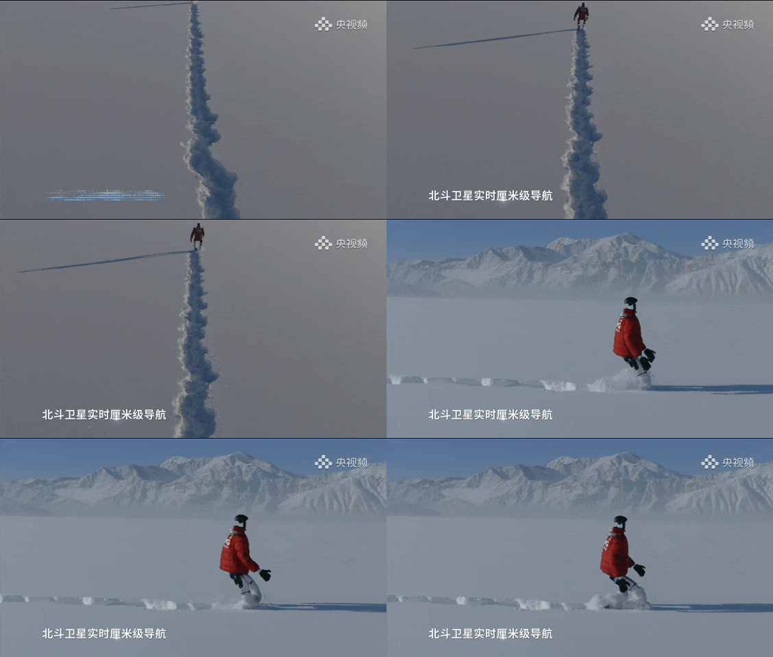
The recent feat of a humanoid robot autonomously drawing giant Olympic Rings in such a harsh climate underscores the incredible advancements in high-precision positioning technology. The success of this mission is a testament to the innovative capabilities of SpatiX's high-precision positioning systems, which have proven to perform exceptionally even in the most adverse conditions.
SpatiX High-Precision Positioning Technology Explained
SpatiX.ai specializes in providing centimeter-level positioning accuracy through advanced GNSS technologies, including Real Time Kinematic (RTK) and Precise Point Positioning (PPP). These technologies are essential for applications requiring high precision, such as autonomous vehicles, drones, and, in this case, humanoid robots.
RTK and PPP work by correcting the GNSS signals in real-time, reducing errors caused by atmospheric disturbances and improving spatial data accuracy. This level of precision is crucial for operations in GPS-denied environments, where traditional methods fall short. By integrating SpatiX's solutions, the humanoid robot was equipped with the necessary tools to navigate and execute its mission flawlessly, despite the challenging conditions.
The Role of SpatiX Arc Terminal in Extreme Conditions
At the core of this successful mission was the SpatiX Arc Terminal, a mission-critical hardware component designed to withstand extreme conditions. Built to automotive-grade standards and rated IP68, the Arc Terminal ensures flawless operation even at temperatures as low as -47.4°C.
One of the standout features of the Arc Terminal is its high-precision heading capability, achieved through SpatiX's proprietary "Beacon" algorithm. This algorithm enables the device to maintain a heading accuracy of 0.2°, which is vital for the robot to follow a precise path and complete its task accurately. Additionally, the Arc Terminal supports hybrid GNSS positioning, ensuring reliable spatial data delivery in remote regions without traditional network coverage.
Ensuring Centimeter-Level Accuracy in Remote Regions
Achieving centimeter-level accuracy in remote and extreme environments requires more than just robust hardware. It involves a comprehensive integration of algorithms, hardware, and services to ensure consistent performance. SpatiX's high-precision positioning technology excels in this regard, providing seamless integration and reliable data even in the most challenging conditions.
The humanoid robot's mission in Altay was further supported by SpatiX's advanced ionospheric optimization and redundant multi-center architecture. These features enhance the stability and reliability of the positioning data, ensuring that the robot could maintain its path and complete its task without deviation. This level of precision is essential for applications such as autonomous driving, UAV inspection, and precision agriculture, where accuracy and reliability are paramount.
Case Study: Autonomous Drawing of Olympic Rings
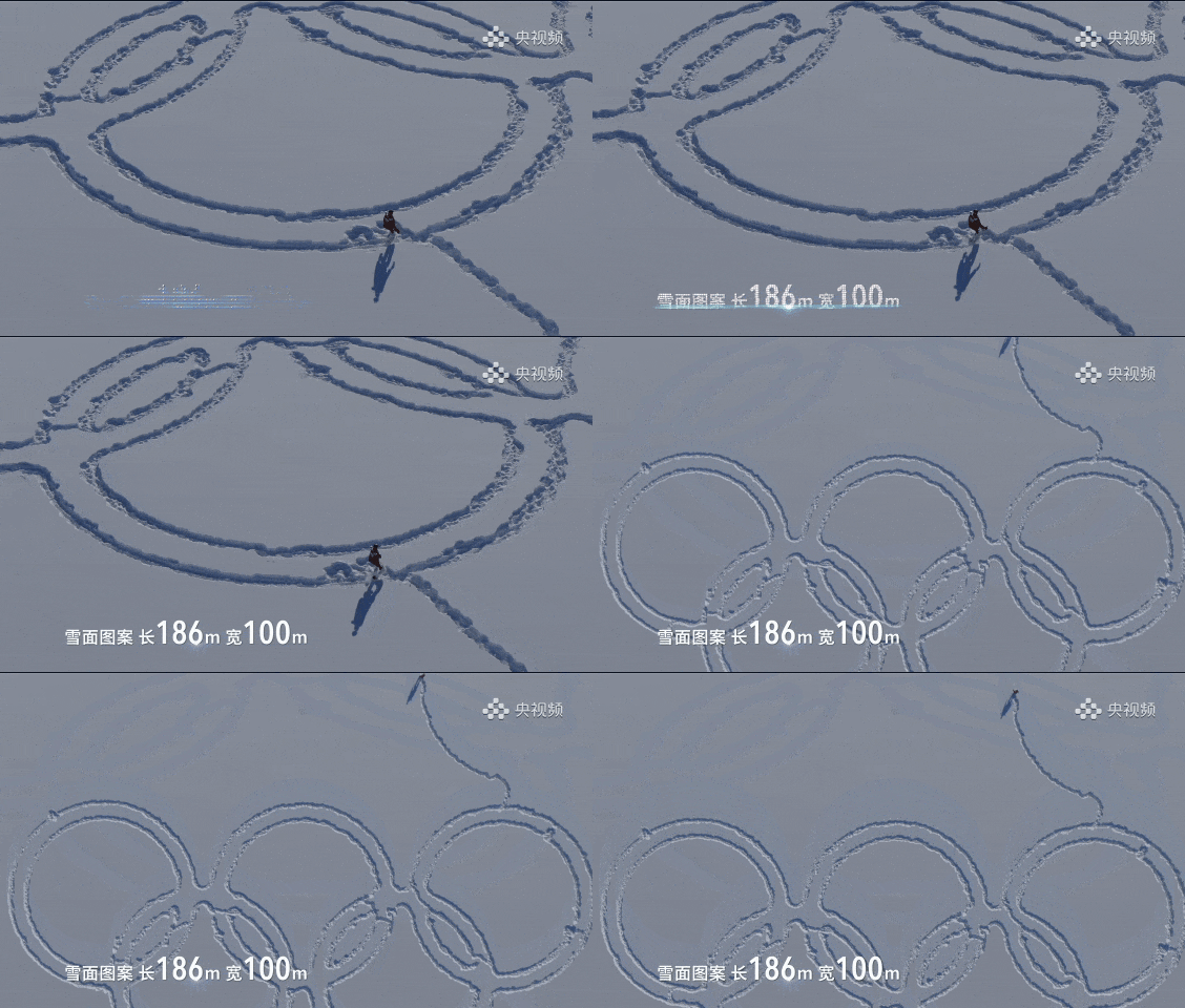
The highlight of this technological achievement was the autonomous drawing of giant Olympic Rings (186m x 100m) by the humanoid robot in the frozen plains of Altay. This task required impeccable precision and stability, as any deviation could compromise the entire pattern. SpatiX's high-precision positioning technology played a crucial role in ensuring the success of this mission.
With constant centimeter-level accuracy and stable attitude perception provided by SpatiX's solutions, the robot completed a 130,000-step trek autonomously. This case study not only demonstrates the capabilities of SpatiX's technology but also showcases its potential for future applications in various industries. The mission's success was a testament to the reliability and innovation of SpatiX's positioning solutions.
Future Applications of SpatiX in Harsh Environments
The success of the humanoid robot's mission in Altay opens the door to numerous future applications of SpatiX's high-precision positioning technology in harsh environments. Industries such as construction, agriculture, and infrastructure can benefit significantly from these advancements, improving efficiency, safety, and operational reliability.
For instance, in precision agriculture, SpatiX's technology can enhance field data collection and reduce rework, leading to more efficient and sustainable farming practices. In construction, the ability to operate in GPS-denied environments and perform contactless measurements can improve safety and accessibility in hazardous areas. Additionally, the technology's real-time 3D modeling capabilities can revolutionize UAV inspection and infrastructure monitoring.
SpatiX's commitment to innovation and reliability ensures that its solutions will continue to push the boundaries of what is possible in high-precision positioning. As industries increasingly adopt these technologies, the potential for new and exciting applications will only grow, further solidifying SpatiX's position as a leader in the field.