
SpatiX Q700: Redefining Efficiency and Precision in Modern GNSS Surveying

In today’s fast-moving construction and surveying industry, professionals are under increasing pressure to deliver accurate results faster, with fewer personnel and lower operational complexity. Traditional surveying workflows often involve multiple steps, repeated point verification, and communication challenges across the field.
That’s where the SpatiX Q700 changes the game.
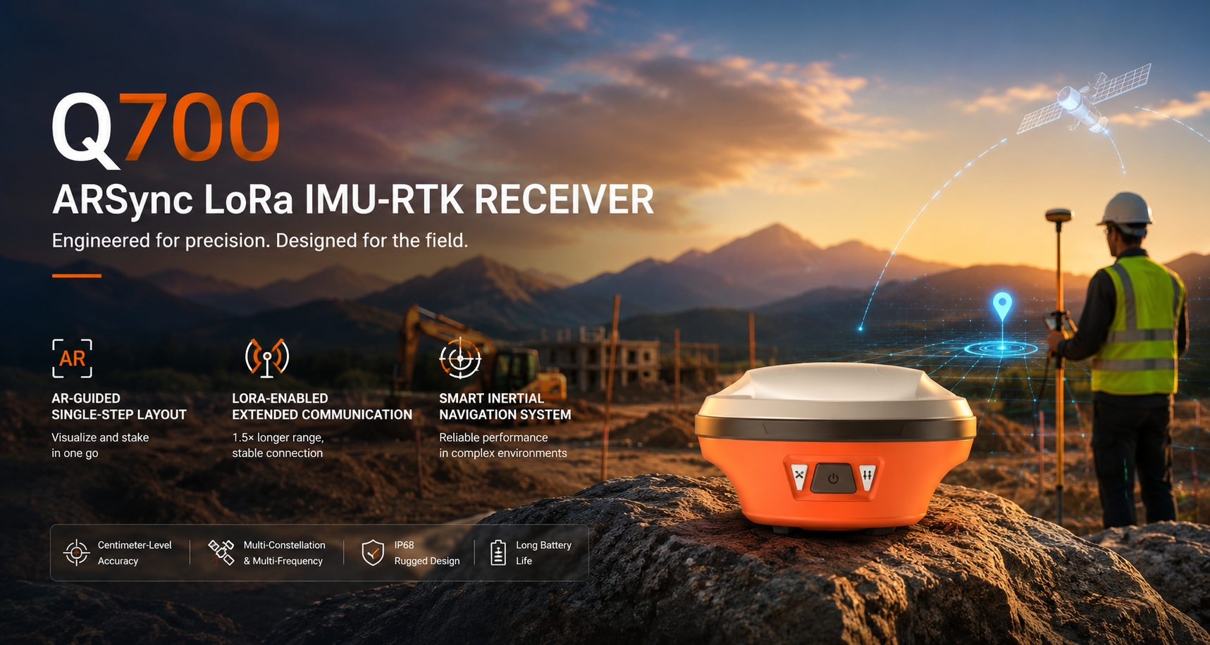
Built for modern surveying, construction layout, and engineering applications, the Q700 is a high-performance GNSS RTK receiver designed to simplify workflows while maintaining centimeter-level precision. Combining advanced AR guidance, intelligent inertial navigation, and extended LoRa communication technology, the Q700 helps field teams work more efficiently in demanding environments.
Explore the official product page here: SpatiX Q700 Official Product Page
Why Modern Surveying Teams Need Smarter GNSS Solutions
Surveying and construction professionals today face several common challenges:
- Increasing project complexity
- Labor shortages and rising operational costs
- Tight project timelines
- Signal interference in urban and obstructed environments
- Communication limitations on large job sites
Modern GNSS receivers are no longer judged solely by positioning accuracy. Professionals now demand:
- Faster stakeout workflows
- Reliable performance in difficult environments
- Easier operation for field crews
- Better communication range
- Improved productivity with fewer steps
The SpatiX Q700 was engineered specifically to address these challenges.
What Makes the SpatiX Q700 Different?
AR-Guided Single-Step Layout
One of the standout features of the Q700 is its AR-guided single-step layout capability.
Traditional stakeout workflows often require repeated coordinate checking and multiple adjustments before reaching the target point. The Q700 streamlines this process by integrating augmented reality guidance directly into the surveying workflow.
With AR-assisted visualization, users can:
- Visualize target points in real time
- Perform layout and stakeout in a single step
- Reduce manual interpretation errors
- Improve field efficiency and usability
This feature is especially valuable for:
- Construction stakeout
- Road and infrastructure projects
- Utility installation
- Site layout verification
- Engineering surveys
The result is faster task completion with reduced training requirements for field operators.
Extended LoRa Communication for Large Job Sites
Reliable communication is critical on large construction and engineering projects.
The SpatiX Q700 integrates LoRa-enabled extended communication technology, delivering approximately 1.5× longer communication range compared with conventional solutions.
Benefits include:
- Stable RTK correction transmission
- Better connectivity across large construction sites
- Reduced signal interruption
- Improved workflow continuity
- Greater operational flexibility in remote environments
For teams working in infrastructure development, mining, land surveying, or expansive industrial projects, extended communication capability can significantly improve operational efficiency.
LoRa technology is widely recognized for enabling long-range, stable wireless communication in demanding field conditions.
Smart Inertial Navigation for Challenging Environments
GNSS performance can degrade in environments with partial satellite obstruction, such as:
- Urban canyons
- Dense construction zones
- Areas with trees or structures
- Complex industrial sites
To address this, the Q700 incorporates a smart inertial navigation system designed to maintain stable and reliable positioning performance even in difficult environments.
Modern GNSS + INS integration technologies are increasingly important in professional positioning systems because they help maintain orientation and positioning stability during temporary GNSS interruptions.
Advantages of the Q700’s inertial navigation system include:
- Faster initialization
- Smooth operation during movement
- Reliable tilt compensation
- Improved positioning continuity
- Increased productivity in obstructed areas
This enables surveyors and engineers to continue working efficiently without constantly re-leveling or stopping operations.
Designed for Real-World Construction and Surveying Applications
The SpatiX Q700 is designed for professionals who need both precision and field-ready durability.
Typical applications include:
Construction Layout
Perform accurate building stakeout and site positioning with improved workflow efficiency.
Road & Infrastructure Surveying
Support highway construction, bridge engineering, and transportation projects with reliable RTK positioning.
Topographic Surveying
Capture accurate field data efficiently, even in complex terrain.
Utility & Pipeline Installation
Simplify underground utility layout and verification tasks.
Earthwork & Site Development
Improve grading accuracy and machine guidance support.
Improving Productivity Without Sacrificing Accuracy
For many surveying teams, the biggest challenge is balancing speed with precision.
The Q700 is built to help professionals achieve both.
By combining:
- High-precision GNSS RTK positioning
- AR-assisted stakeout
- Intelligent inertial navigation
- Extended LoRa communication
the system reduces operational friction while maintaining professional-grade performance.
This allows teams to:
- Complete projects faster
- Reduce rework
- Improve crew efficiency
- Lower operational costs
- Increase field productivity
The Growing Demand for Advanced GNSS RTK Receivers
The global demand for intelligent GNSS RTK receivers continues to grow across industries such as:
- Construction
- Surveying
- Agriculture
- Mining
- Smart infrastructure
- GIS mapping
Modern GNSS receivers increasingly integrate technologies like inertial navigation systems (INS), multi-constellation RTK positioning, and enhanced wireless communication to improve reliability and field usability.
As construction and engineering projects become more digitalized, professionals need tools that are not only accurate, but also intuitive and efficient.
The SpatiX Q700 is built for this next generation of field operations.
Why Professionals Are Choosing SpatiX Q700
Field professionals are adopting the Q700 because it delivers practical advantages that directly impact project efficiency:
- Faster stakeout workflows
- Easier operation for field crews
- Stable long-range communication
- Reliable performance in complex environments
- High-precision GNSS RTK positioning
- Reduced workflow complexity
Whether working on construction sites, infrastructure projects, or engineering surveys, the Q700 helps teams operate smarter and more efficiently.
Conclusion
The future of surveying is about more than accuracy alone. It’s about enabling field teams to work faster, smarter, and more confidently.
The SpatiX Q700 combines advanced GNSS RTK technology, AR-guided layout, intelligent inertial navigation, and extended LoRa communication into a powerful field-ready solution designed for modern surveying and construction professionals.
Learn more about the SpatiX Q700 here: